
Draw the World: Hands-On Learning Stations
There is something that happens in your brain when you draw the world. Even though you may not automatically memorize the countries or continents, you have greater observations when you draw it than when you simply label something. Both are great tools for learning though. Kids of all ages can learn and enjoy geography with a few simple tools and a little bit of time.
I'm focusing on Geography this week in my 31+ Days of Hands-On Learning Stations series, and today is all about learning to draw the world.
Start with Blob Maps
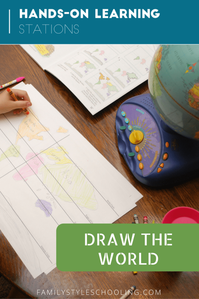
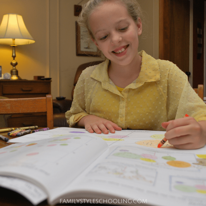
I learned the "blobbing method" of drawing the world from Leigh Bortin's book The Core. In it she describes teaching children to get familiar with the general shape of the continents, and where they are in relationship to one another.
The greatest reference points are the five great circles:
- Arctic Circle
- Tropic of Cancer
- Equator
- Tropic of Capricorn
- Antarctic Circle.
All they need to do is draw a blob (or oval-ish shape) relative to each continent's area. It's really pretty amazing at how beginning with blobbing can give them such a great spacial awareness of the world.
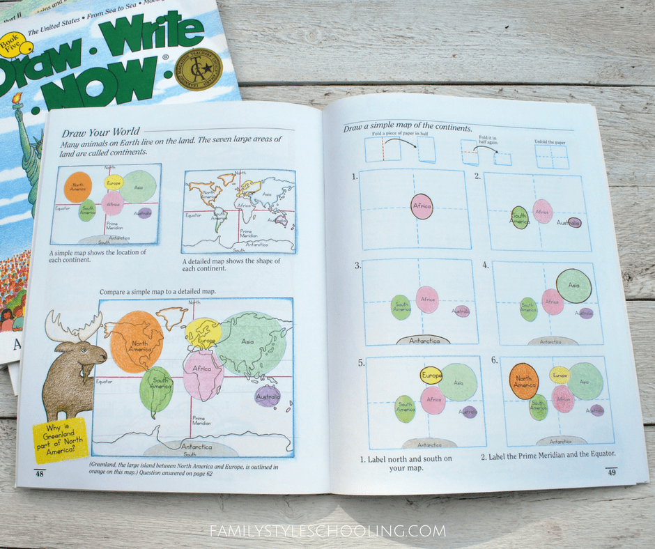
There is also an excellent step-by-step instruction guide to blobbing in Draw Write Now Book 7.
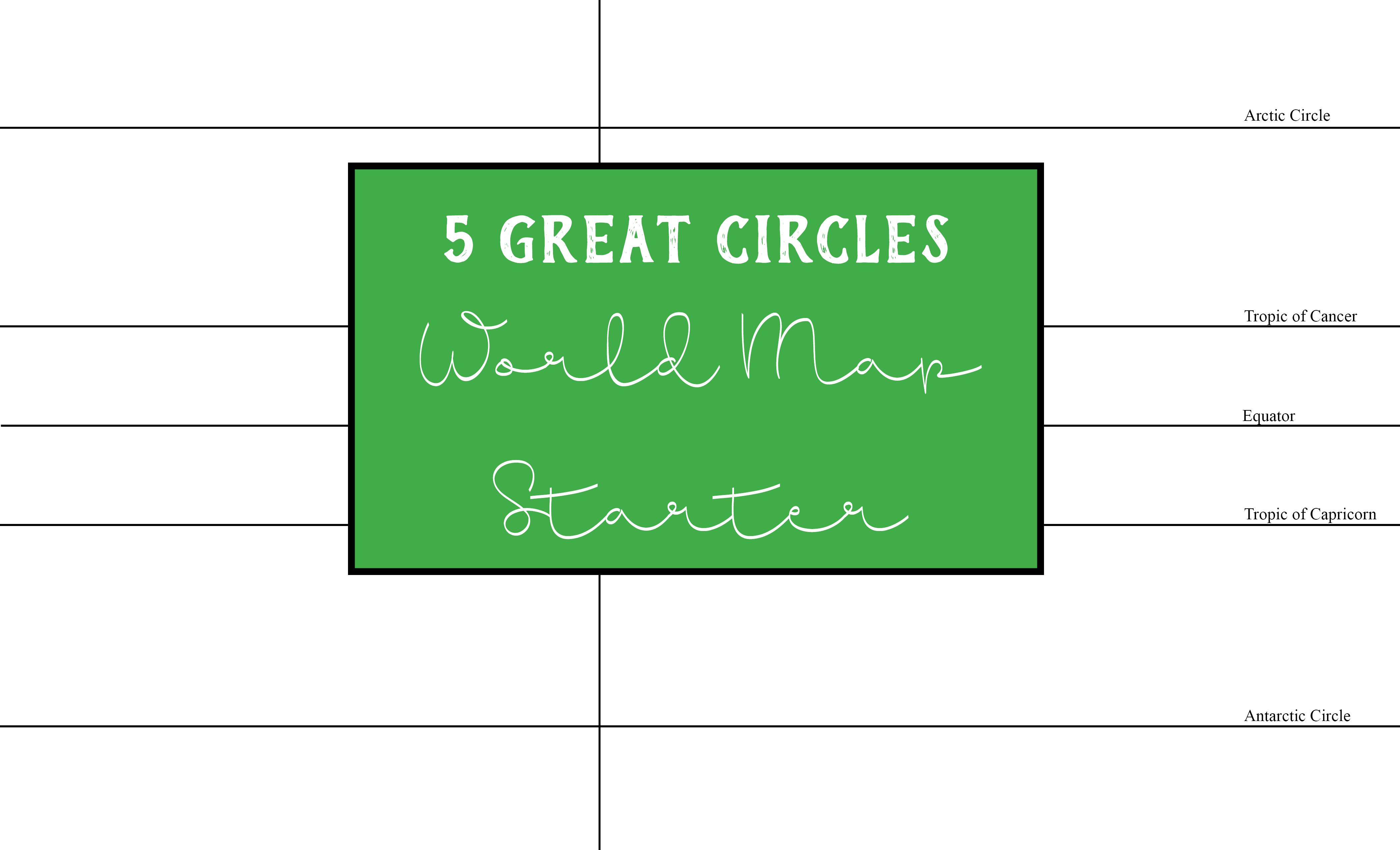
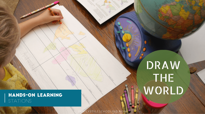
I've made a simple PDF with the great circles for my kids to have something to draw their blobs on easily. It's designed to be printed on paper that measures 8.5 x 14 (legal size) so students can have enough room to fit their world. You can download this free resource here: 5 Great Circles.
Draw the World with Instruction Books
I have talked about the wonderful drawing series by Kristin J. Draeger many times. I love how she breaks down drawing the details of different countries or continents.

There is also other great resource for younger kids if you're looking to introduce them to drawing the world:
Draw-Write-Now Book Series
- Book Seven highlights drawing the world
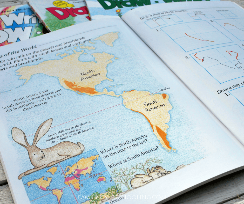
- Book Eight focuses on the shape of North America and South America
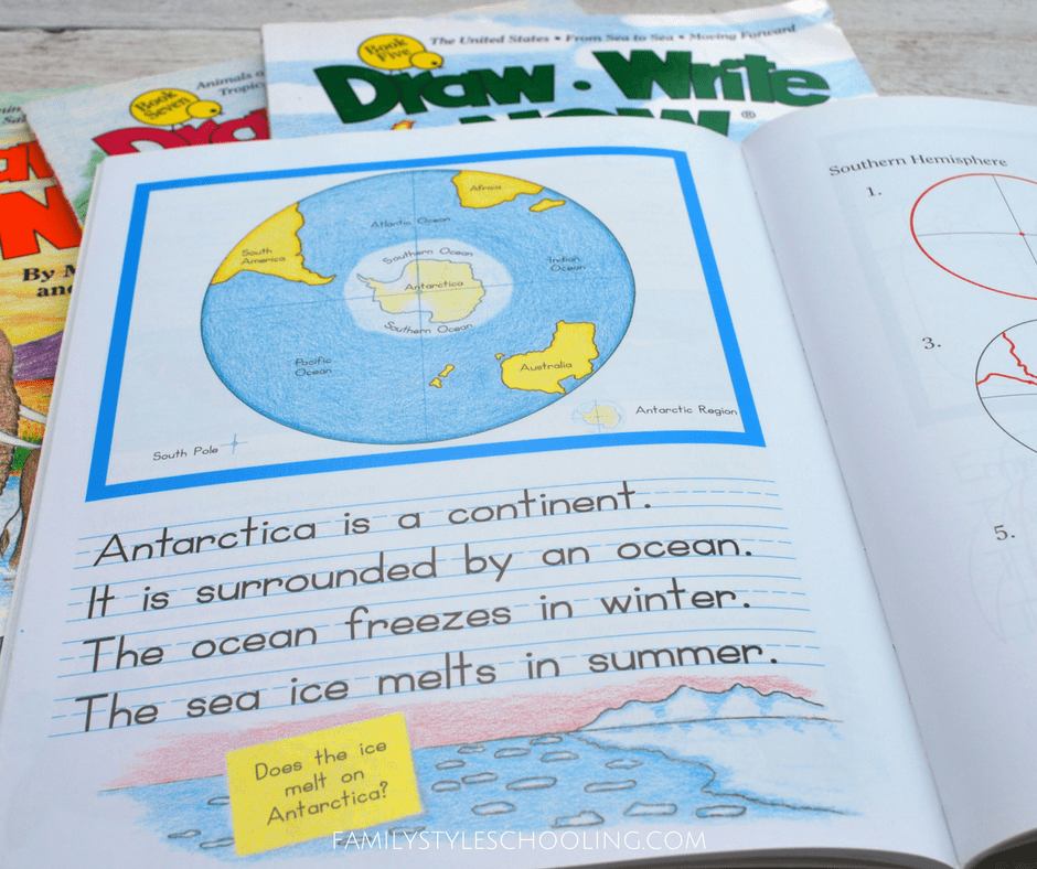
- Book Four gives instructions for drawing Antarctica
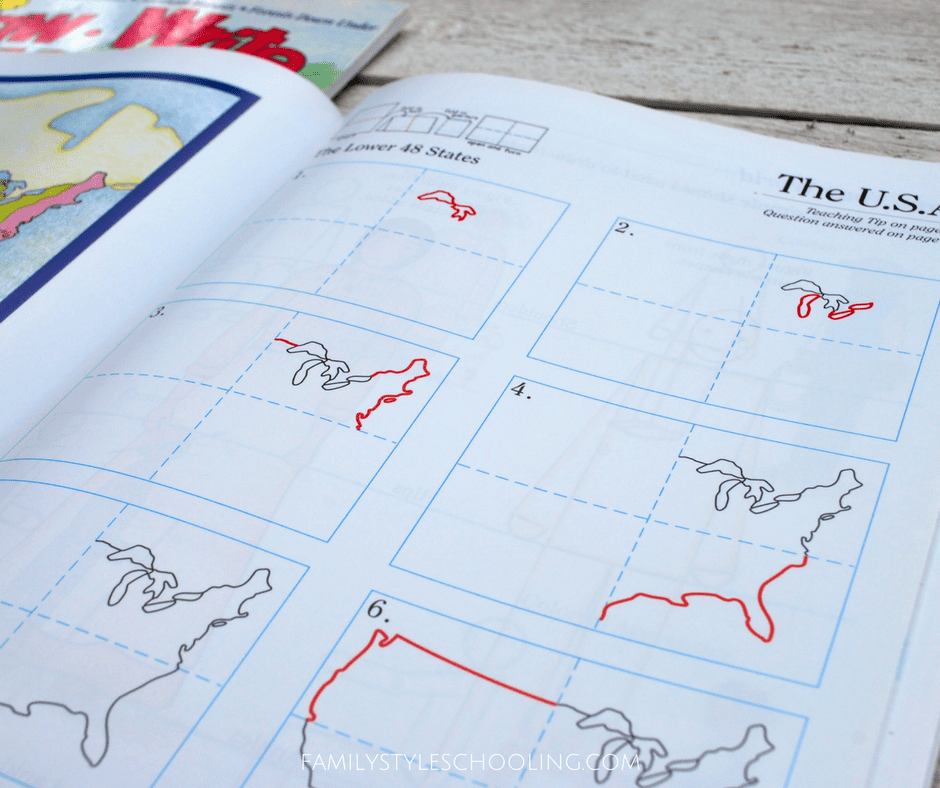
- Book Five draws the outline of the United States
I love that my kids are learning the world through art. It cultivates multiple skills at once, and allows for a lot of fun along the way!
How do you help your students to draw the world?
Check out more hands-on learning stations inspiration in my 31+ Days of Hands-On Learning series!
Other Geography Inspired Stations:
Betsy Strauss is an unexpected homeschooler, mother of three, who is in a relationship with a sweet man for life. She loves reading books, drinking coffee, and learning anything with her kids.
Thank you for all your wonderful resources! I tried the link to “5 Great Circles” but it doesn’t seem to be working. Where might I find another copy?
Appreciate you guys!!
Sorry for the troubles! Try this link: https://drive.google.com/file/d/0B2gmAO4S5tkYclNyZU53MFV3UWM/view?usp=sharing&resourcekey=0-WWLEpErhpvLej3UOFCVS4w