7 Tips for Learning to Draw the World
I'm journeying through Challenge A with my second child, and we're back to drawing maps together. Learning to draw the world is one of my favorite aspects of the Challenge A program not only because I really enjoyed it myself, but because I've seen the value of having a general map in your head when studying history. It has really given me a deeper perspective on my reading as I picture the places I read about in books.
Don't misunderstand me. I did not successfully draw the entire world from memory with 7,000 countries, capitals, and features labeled at the end of my Challenge A year. I was a tutor, and I tried to keep up, but this old brain is sluggish. Even though I didn't come out with a frame-able product, I did gain a great amount of understanding through the work I did complete, and that was valuable to me. That's what attempting to draw the world is about. It's about getting to know this crazy place we live on. It's about realizing that political boundaries are often drawn because of physical features. It's observing, memorizing, and persevering.
I didn't make it all the way through, but I'm at it again, and I hope to get further this year. I want to offer seven tips that have helped me in learning to draw the world.
#1: Pace Yourself
Just as the Challenge guide is a framework for your studies, the geography lists of countries, capitals, and features are a suggestion for great things to memorize. If this is your first time in CC, or your first attempt to draw any continent, don't expect to be able to draw and label the entire United States with all 41 rivers listed. That is a whole lot of new information. Scale it back a bit. Learning to draw the world is more of a marathon than a sprint.
Instead, try to find a reasonable amount of features to expect from yourself or your student. If spelling is an issue, give them a word bank for their test in class to copy from. The goal is to get familiar with the world. Drawing just requires a higher level of observation than labeling a pre-drawn map. Don't give up on the drawing, just don't expect a masterpiece either!
#2: Draw the General Shapes
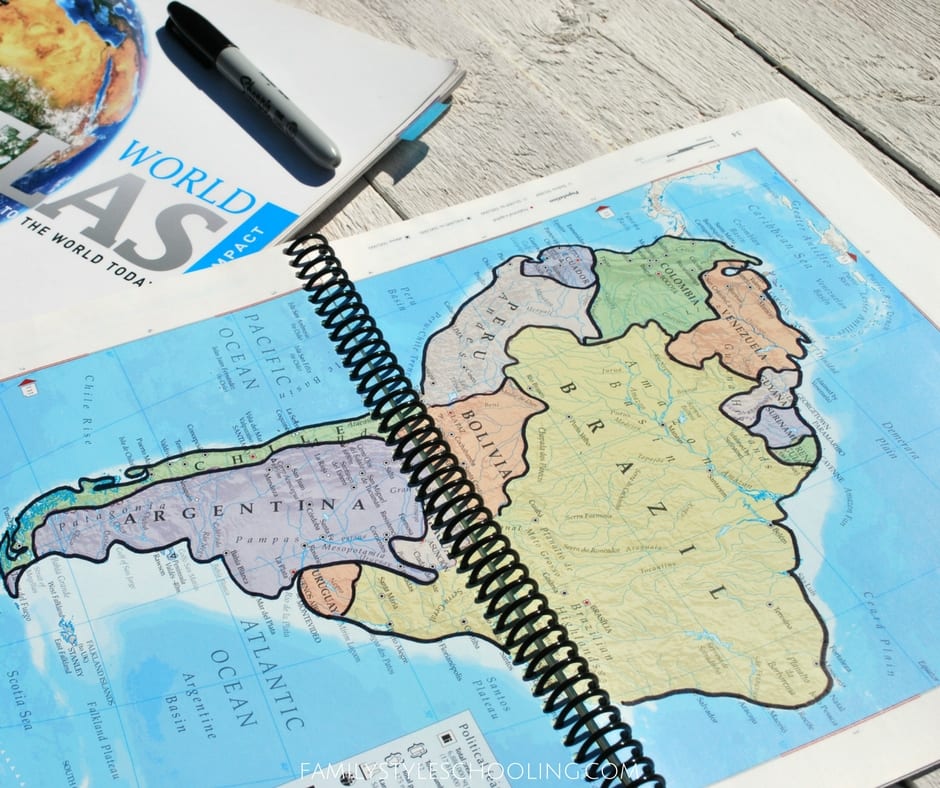
I've seen kids get so lost in trying to draw every zig and zag of a coast line. They get so consumed with their maps looking like the atlas, that they lose sight of the bigger picture. If it takes you four hours to draw one map, it's going to be hard to lock that into your memory, or even want to draw it a second time.
If your child struggles with this, take a black sharpie and smooth out the coast lines in your atlas. Yes. I recommend writing in your book. What is more valuable: a $15 book, or your sanity? Draw over the zig-zag coastlines and help them see simpler shapes.
#3: Use Big Paper
It is really hard when you're first getting started to get all of a single continent to fit on a small piece of paper. The more you become comfortable drawing that continent, the smaller space you need. In the beginning though, I recommend using a bigger piece of paper because you won't stress about running out of space. Try some of these options:
#4: Dry Erase in the Beginning
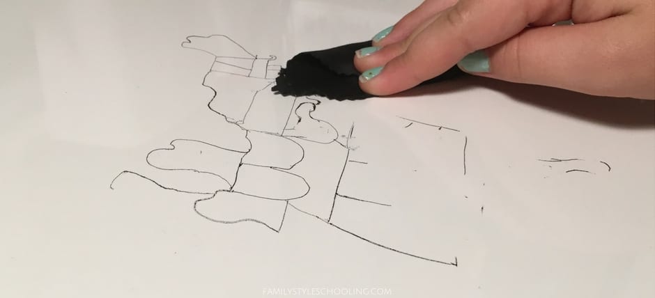
Dry erase happens to be very forgiving. When you're first starting to draw a continent, you'll get really frustrated fast if you have to erase every other second, and your paper ends up all smudgy because of all of your edits. Dry erase markers give the student freedom to try the same line over and over without the consequences of a messed up page. If you want to save the work in the end, snap a picture of it with your phone and then erase.
#5: Learn From a Guide
I love how the books like Draw Europe simplify the shapes of the countries. While I own all of the series, I don't think you have to get them all. Just learning how she breaks down each continent into familiar shapes gives you a great idea of how to repeat the same idea with other continents. Here are some of my favorite geography drawing guides:
- Draw Canada and Greenland
- Draw USA
- Draw Mexico, Central America, and South America
- Draw Europe
- Draw Asia Volume I
- Draw Asia Volume II
- Draw Africa
- Mapping the World by Art
- The Little Man in the Map
My top three favs from the draw series are the USA, Europe, and Africa.
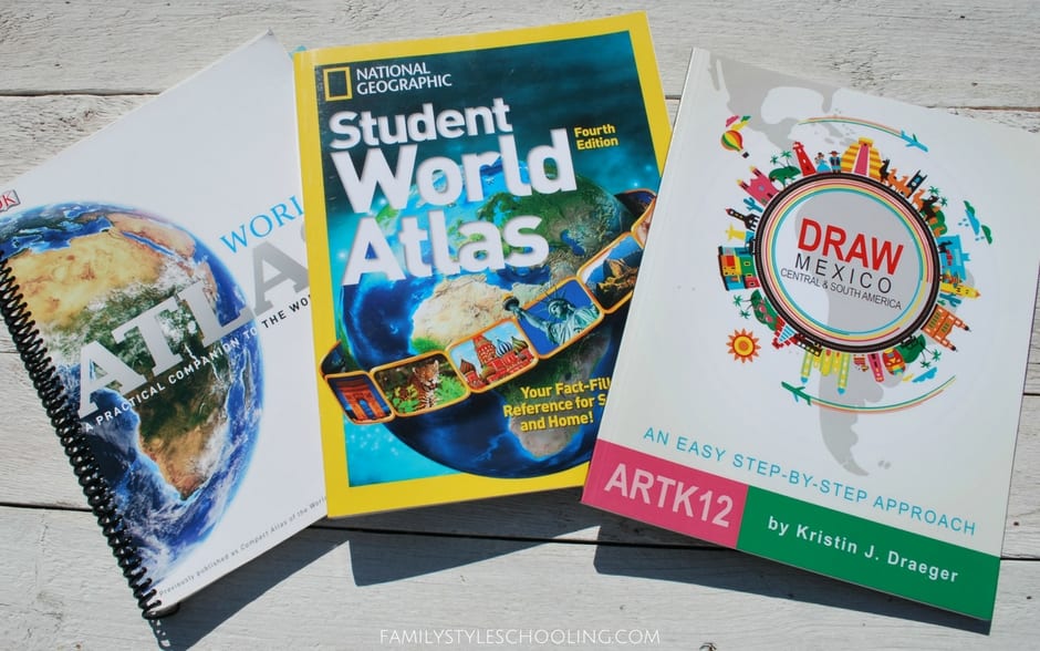
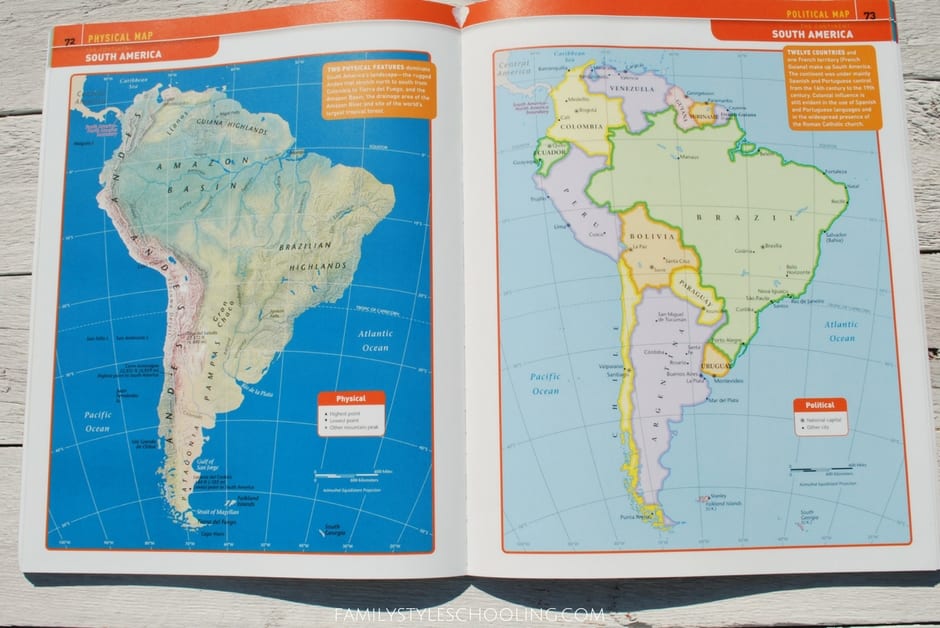
It's also great to have an additional atlas or a globe nearby to get a different perspective on the area you're trying to draw. I really like the National Geographic Student World Atlas because it shows the entire area all on one page.
#6: Draw Quickly
Once you've got the idea of the area, time yourself. See how much you can draw in five or ten minutes. You'd be surprised at how much you recall. The three keys to memorizing are repetition, intensity, and duration. You'll get more repetitions of a map drawn quickly than you will of a map that's a beautiful masterpiece. After repeating the drawing over the course of time, you will find that you've stored more than you ever thought you could into your brain.
This also gives you opportunities for playing games with your map. Challenge yourself. How many items can you draw in five minutes? Count your items, flip the page over and see if you can beat your score. It's not about perfection, but memorization.
#7: Use Grid Lines on the Map for Reference
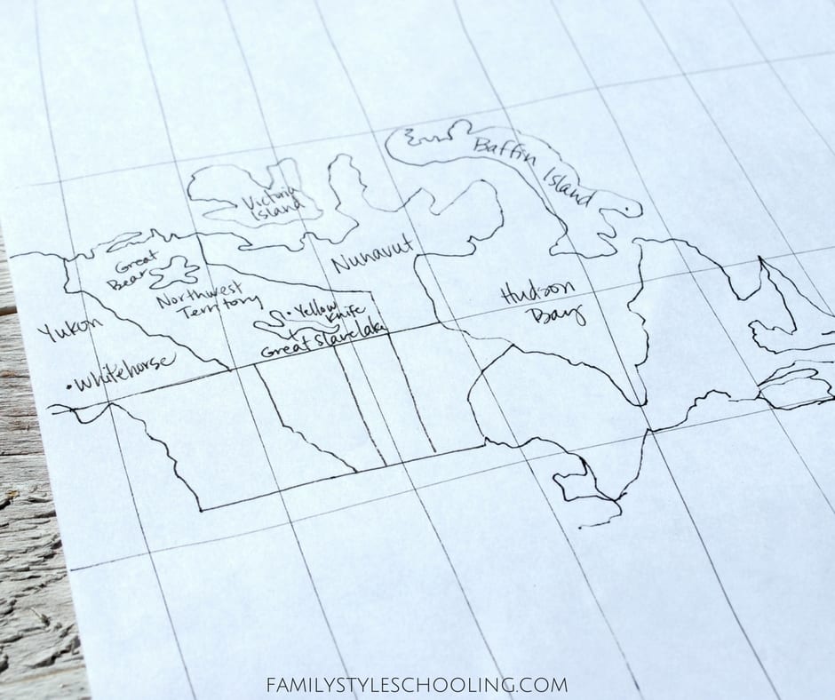
One of my most memorable childhood art projects was using a grid to enlarge a comic strip. Thankfully the globe has lines of latitude and longitude built in that create a natural grid to use to do the same thing with your map.
Check this idea out:
You can use the Mercator map grid to draw a flattened out version of the world. This can be really helpful for taking the map drawing one bite at a time.
A Bonus Tip as You Draw the World
Make your drawing time enjoyable. Any time there is added stress in a challenging subject, it's just going to make everything more difficult. Try some of these ideas for joy in drawing:
- Friends always make things better. Maybe your student wants a study partner.
- Eat a snack while drawing...fuel up!
- Find great videos on YouTube for exploring life in the regions you're drawing
- Turn on some good music or a great story on Audible
What are your tips for drawing the world?
Betsy Strauss is an unexpected homeschooler, mother of three, who is in a relationship with a sweet man for life. She loves reading books, drinking coffee, and learning anything with her kids.


Hi, Betsy,
Hoping you can answer a question for us. The Draw Asia volume one and two seem to build on each other. Is that correct? Does volume one cover all of East Asia? Is it necessary to purchase both volumes?
Thanks for your help!
Volume two covers East Asia. She starts the book off building from the map that was drawn in Draw Asia one, but you can download the template (what is drawn in volume one) here: http://artk12.com/artk12-downloads/ I don’t think it’s necessary to purchase both volumes!
Hope this helps!
Thanks, Betsy! You’re great. Our girls have so enjoyed Drawing Africa, that I wanted to purchase another. I appreciate your help.
Dee Dee
You’re welcome! Glad you’re enjoying them.
The spiral bound book I am seeing in the first few images….is that something you created?
I just spiral bound my atlas. I wanted it to lay flat while I drew. You lose a bit of the info in the center, but it’s hard to see in the crack of the book anyway!
Which atlas was this? I am very interested in spiraling one for next yr, in Challenge A. Any specific office supply do the spiraling?
This is the Compact World Atlas. It used to be in the resource list for Challenge A. My favorite atlas now is the National Geographic Student World Atlas. I like it because it has whole continent drawings that are easier to follow in the drawing like we do in CC.
Why don’t you post some tutorials on how to draw each country?
I really don’t think I could do any better than the draw series I mentioned above! I really love those resources!
I really don’t think I could do any better than the draw series I mentioned above! I really love those resources!
Thank you for the info! Do you have a method that figure out the distances for the Mercator projection lines for 18×24 inches paper size or any other large poster size? After reading Challenge A guide’s method, it’s still very confusing. Thank you for sharing your wisdom with us!
No I don’t. It was always tricky to me too, so we just did the best we could! Let me know if you find something out!
This was used on “17×11″ paper (or actually, two 8.5″x11” pages taped together!) https://www.youtube.com/watch?v=V955rrpO0vk This was also specifically for Classical Conversations 🙂
Hi! Are the newer editions (5th and 6th) of the National Geographic Student World Atlas as good as the 4th edition that you shared about here- for Challenge A students?
I would assume that they would be just as good. As far as atlases go, it seems like the best practice is to get the most up-to-date version since it will represent any changes that have happened in the world.
After reading these amazing tips, thank you so much Betsy, I started searching for the Atlas she recommended. In reviewing the 5th and 6th editions of this atlas, I noticed that there is a difference in grade level for each new edition. For instance, the edition she recommends here is suited for 7th-10th grade maybe? And the 5th and 6th editions were best suited for older high school students. Im assuming this means the newer versions are more detailed? Not sure what you are looking for in terms of details etc but just something I found helpful when trying to choose which edition I wanted. I am a Challenge A tutor this year for my daughters class and I chose to use the edition she recommended here as an added resource along with the CC cartography curriculum and a world map I picked up off Amazon. Maybe this is helpful? Also… Betsy, I found your website after finding “Latin with Andy” which we absolutely LOVE! Thank you for all the help you and your family have given my family!
Thanks for the insight into the different editions! That is really helpful!
These are fantastic ideas! I am gearing up for my 2nd round of challenge A and I wish I had found this the first time around. Thank you for sharing.
Hi Betsy! I have been pouring over your posts for Challenge A and I am so appreciative for all your tips and tricks! I have one starting A next year, and one more coming up. I have a question for you, which I haven’t seen addressed yet. I think I understand that in A they are looking at an image and then drawing it on a separate piece of paper. To prepare for A, could my students trace the blackline triviums to get an idea, or should they go straight to transferring? I’d love your input!
Sorry for the delayed response! Yes! Trace away! It’s a great way to get familiar with the maps. Sometimes I have seen students get overwhelmed with the tiny details in tracing…like thinking that they have to follow every little squiggle on the coast of Alaska. I’ve found looking for patterns and connections in the shapes actually helps learn the maps a little faster and definitely enough to know the relationships of places around the world. So really the key is to see what works best for your student. If tracing gives them confidence to practice more, go for it!